- Home
- Missions
- Data
- Communications
- People
- The Earth Observer Newsletter
Recent Imagery
You will be directed to the NASA Visible Earth webpage when you select Images by Mission below, or click on the images at right that are randomly generated to represent four out of all possible topics.
Announcements and Highlights
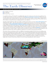
The Earth Observer: Sep - Oct, 1993
In This Issue
Click title below to view page
Problems encountered when copying/pasting. Need to retype manually.
Editor's Corner
Michael King, EOS Senior Project Scientist
The EOS Payload Advisory Panel meeting was held October 4-6 in Herndon, Virginia. The primary focus of this meeting was on coordination and convergence of EOS mission elements with other programs, such as (i) EOS PM in light ofESA's plans for METOP-1 as well asNOAA's plansforNOAA-0, P, Q and the Department of Defense's plans for DMSP, (ii) EOS Chemistry in light ofESA's plans for ENVISAT-1 in 1998, (iii) remote sensing of land in the EOS era in light of Landsat 7 / 8, EOS AM-2, EOS PM· 2, and SPOT, and (iv) TOPEX/Poseidon follow-on in light of plans for Geosat follow-on and EOS Ocean Altimetry (SSALT/ DORIS/ TMR).
In addition, the Payload Advisory Panel reiterated the importance of EOS Aerosol (SAGE III) in mid-inclination (56°-73°) orbit (spacecraft and launch to be provided by an international partner) and a new TOMS instrument on Chemistry-I (to be provided by NASDA). Furthermore, the Payload Advisory Panel recommended in its report that the project proceed with plans to split the EOS Altimetry mission into two separate spacecraft for EOS Land-Ice Altimetry (GLAS) and EOS Ocean Altimetry, respectively.
The EOSDIS Advisory Panel also wrote a section of the report on the status and challenges of EOSDIS, in which they articulated the need to improve the interaction between EOSDIS and the user community, to assure a fully functional, and valuable, data and information system. The full Executive Summary of the joint Payload Advisory Panel and the Data and Information System Advisory Panel Report is intended to appear in the November/ December issue of The Earth Observer.
On November 12, I sent out a letter to each Team Leader, Principal Investigator, and Interdisciplinary PI that contained a complete list of at-launch and post-launch data products with their corresponding geophysical parameters, storage volume, floating point operations per second, accuracy, etc. This information was the result of an extensive analysis by the Project Science Office following the last IWG, and allows us to identify the "tall pole" algorithms based on either their data storage or processing requirements.
Read more...