
Featured Content
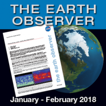 |
Starting a New Year: The Jan - Feb 2018 Issue of The Earth Observer NewsletterNASA will commemorate the 60th anniversary of its establishment later this year (2018), with various milestones being celebrated throughout the year. For example, January 31, 2018, marked the 60th anniversary of the launch of Explorer 1, the first U.S. space satellite. The January-February issue of The Earth Observer newsletter highlights results from an assessment of missions in extended operations, provides a status on recently launched assets that build on heritage missions, and reports on the release of recommendations for the prioritization of Earth science observations in the coming decade. The issue also highlights NASA’s recent outreach activities at the American Geophysical Union (AGU) Fall Meeting, and summarizes recent science meetings and workshops such as the Interagency Workshop on Societal Applications of Satellite Data for Ocean Health and Fisheries. |
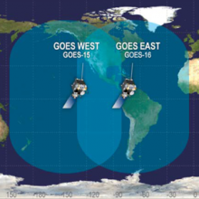 |
GOES-16: The First in a New Generation of Geostationary SatellitesGOES-R is the latest NOAA–NASA GOES mission; it launched on November 19, 2016, and was renamed to GOES-16 after launch and on-orbit checks were complete. GOES-16 is the first in the GOES-R series, which includes GOES-R, -S, -T, and -U, that will launch between now and 2025, ushering in a new era of geosynchronous observing capabilities. The November-December 2017 issue of The Earth Observer includes a feature article about GOES-16, approximately one year after launch. The article introduces the GOES-16 satellite’s improvements, including spacecraft design, its manifest of advanced instruments, resultant data products, and anticipated societal benefits. |
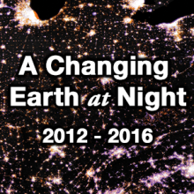 |
A Changing Earth at NightSatellite images of Earth at night—often referred to as “night lights”—have been a gee-whiz curiosity for the public and a tool for fundamental research for nearly 25 years. The map on the front of this poster shows the change in lighting intensity from 2012 to 2016. The map was created using two separate night lights datasets (from 2012 and 2016) derived using data from the Visible Infrared Imaging Radiometer Suite (VIIRS) on the National Oceanic and Atmospheric Administration (NOAA)-NASA Suomi National Polar-orbiting Partnership (NPP) satellite. The back of the poster explains how scientists use night lights data from VIIRS to study our planet at night. |
 |
2017 AGU Schedule of Events at the NASA BoothAre you traveling to New Orleans to attend the 2017 AGU Fall Meeting, held December 11-15, 2017? If so, please plan to visit the NASA Booth (#1645). Navigate the streets (or rues) of the NASA Booth and immerse yourself in science. Join us at the Inspiration Theatre for science stories, share a piece of your personal history involving NASA at NASA’s Living Timeline exhibit, and make new science connections while strolling down Avenues Interconnected, Impact, Innovation, and Inspiration. Please see the program for a full list of events. Learn something new, have fun, and discover together! |
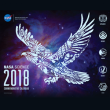 |
NASA Science 2018 Commemorative CalendarThe NASA Science 2018 Commemorative Calendar is now available online. |
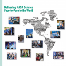 |
NASA's Science Communication Support Office Annual Report 2017The Science Communications Support Office (SCSO) supported 18 domestic and international science conferences and 6 public events in 2017. The SCSO continues to provide an inspiring and interactive venue for every event during the year, using a unique storytelling approach that allows a variety of audiences worldwide to connect with NASA Science. The 2017 Annual Report provides an overview of these activities with details about new Hyperwall stories, publications, social media, key partnerships, and more! |
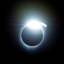 |
NASA Provides Unique Views of the 2017 “Eclipse Across America”On Monday, August 21, 2017, all of North America was treated to an eclipse of the sun, with some locations experiencing a total solar eclipse—where the sun was 100% obscured by the moon’s shadow, or umbra. In the September-October 2017 issue of The Earth Observer, we briefly summarize NASA Television’s Eclipse Across America coverage—a four-hour broadcast that took place on the day of the eclipse from 12:00 to 4:00 PM Eastern Daylight Time (EDT). Throughout the summary are discussions of some of the science activities that were conducted, as well as several "Perspectives from the Path" that describe personal anecdotes from eyewitnesses who had been asked to describe their respective eclipse experiences for this article. |
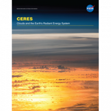 |
CERES FM6 on JPSS-1The Clouds and the Earth’s Radiant Energy System Flight Model 6 (CERES FM6) instrument is scheduled to launch onboard the Joint Polar Satellite System-1 (JPSS-1) in November 2017. The CERES instrument measures reflected sunlight and thermal radiation emitted by the Earth. Data products from CERES include both solar-reflected and Earth-emitted radiation from the top of the atmosphere to the Earth’s surface. These measurements, called radiative fluxes, represent the amount of energy radiated through a given area within a given time range. CERES provides the only global top of atmosphere energy budget dataset. Data from CERES FM6 will help scientists further develop a quantitative understanding of the links between the Earth’s energy budget and the properties of atmosphere and surface that define it. |
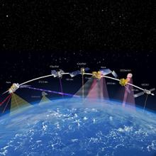 |
The Third A-Train Symposium: Summary and Perspectives on a Decade of Constellation-Based Earth ObservationsThe third international A-Train Symposium took place April 17–20, 2017, in Pasadena, CA, and brought 285 scientists together to learn about and exchange scientific findings from data collected by a unique constellation of Earth-observing satellites called the Afternoon Constellation, or “A-Train.” Now in full operation for over a decade, the A-Train has transformed our undertstanding of, and the way we study Earth’s interacting systems. In the July-August issue of The Earth Observer we present a summary of the symposium. We first address the development of constellation flying concepts and the satellites that make up the constellation. Next, we provide a brief mention of the previous A-Train symposia and—finally—a summary of the third symposium. |
 |
Data Discoverability, Earth Day, and More!At present, there are nearly 22 petabytes (PB) of archived Earth Science data in NASA’s Earth Observing System Data and Information System (EOSDIS) holdings, representing more than 10,000 unique products. The volume of data is expected to grow significantly—perhaps exponentially—over the next several years, and may reach nearly 247 PB by 2025. The May-June issue of The Earth Observer explains the use of Digital Object Identifiers (DOIs) and the important role they play in discovering NASA Earth science data. The issue also reports on two outreach activities that took place in Washington, DC in April—Earth Day and the National Math Festival. |