


Recent Imagery
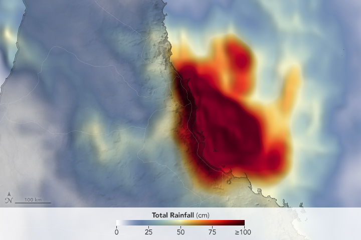
You will be directed to the NASA Visible Earth webpage when you select Images by Mission below, or click on the images at right that are randomly generated to represent four out of all possible topics.

You are here
Soil Moisture Active-Passive (SMAP)
Status:
Current, Extended Mission
Mission Category:
Earth Systematic Missions Program, Decadal Survey 2007
Launch Date: January 31, 2015
Launch Location: Vandenberg Air Force Base
Designed Life: May 31, 2018
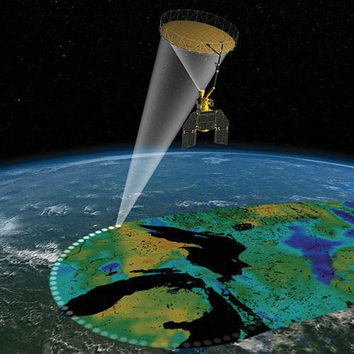
The Soil Moisture Active-Passive (SMAP) mission uses a combined radiometer and high-resolution radar to measure surface soil moisture and freeze-thaw state. Direct measurements of soil moisture and freeze/thaw state are needed to improve our understanding of regional water cycles, ecosystem productivity, and processes that link the water, energy, and carbon cycles. Soil moisture information at high resolution enables improvements in weather, flood, and drought forecasts, and predictions of agricultural productivity and climate change.
The National Polar-orbiting Operational Environmental Satellite System (NPOESS) Integrated Program Office (IPO) has developed a tri-agency set of requirements for the next generation of polar-orbiting operational environmental satellites. A novel approach combining radar-radiometer and L-band mapping of global soil moisture will allow SMAP to far exceed the NPOESS soil moisture threshold (minimum performance) requirements for sensing depth and spatial resolution. With “fast-track” development, it is possible that SMAP could provide critical gap-filling soil moisture measurements for NPOESS, which were lost when the Conical Microwave Imager/Sounder was cancelled from the first NPOESS platform.
Key Soil Moisture Active-Passive Facts
| Mission/Portal Page: | http://science.nasa.gov/missions/smap/ |
|---|---|
| Launch Vehicle: | Delta-2 |
| Altitude:Distance from sea level. | 685km |
| Inclination: | 98° |
| Local Node:Approximate time, at the equator when vehicle is directly overhead. | 6:00 a.m. |
| Instruments: |
L-band Radar L-band radiometer |
| Project Scientist(s): |
Jared Entin |
| Deputy Project Scientist(s): |
Eni Njoku |
Related Publications:
- SMAP Applied Science (Posters - 2.83 MB)
- SMAP (Posters - 2.09 MB)
- SMAP Products (Posters - 2.73 MB)
- Soil Moisture Active Passive (2014) (iBooks - 4.13 MB)
- Soil Moisture Active Passive, Lenticular (2014) (Postcards - 270.61 KB)
- Understanding Earth: Our Ocean (Booklets - 10.39 MB)
Relevant Science Questions:
- How is the global Earth system changing?
- How will the Earth system change in the future?
- What are the primary forcings of the Earth system?
Related Applications:
- Agricultural Efficiency
- Disaster Management
- Public Health
- Weather Prediction