
You are here
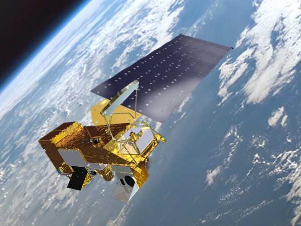
Aqua
Status:
Current, Extended Mission
Mission Category:
Earth Observing System (EOS), A-Train
Launch Date: May 4, 2002
Launch Location: Vandenberg Air Force Base, CA
Designed Life: May 4, 2008
Aqua is a major international Earth Science satellite mission centered at NASA. Launched on May 4, 2002, the satellite has six differrent Earth-observing instruments on board and is named for the large amount of information it collects about water in the Earth system. Aqua gathers this information from its stream of approximately 89 Gigabytes of data a day. The water variables being measured include almost all elements of the water cycle and involve water in its liquid, solid, and vapor forms. Additional variables being measured include radiative energy fluxes, aerosols, vegetation cover on the land, phytoplankton and dissolved organic matter in the oceans, and air, land, and water temperatures.
Due to fuel limitations, Aqua completed the last of its drag makeup maneuvers in December 2021 and is now in a free-drift mode, slowly descending below the A-Train and drifting to later equatorial crossing times, and lower altitudes. In Fall of 2026, passivation of the aircraft will begin.
Key Aqua Facts
| Reference Handbook: | |
|---|---|
| Data Links: |
earthdata.nasa.gov |
| Launch Vehicle: | Delta II 7920-10L rocket |
| Altitude:Distance from sea level. | 705km |
| Inclination: | 98.2° |
| Local Node:Approximate time, at the equator when vehicle is directly overhead. | 1:30 p.m. |
| Origination: | Joint with Japan and Brazil |
| Instruments: |
AIRS (Atmospheric Infrared Sounder) AMSR-E (Advanced Microwave Scanning Radiometer for the Earth Observing System) AMSU-A (Advanced Microwave Sounding Unit-A) CERES (Clouds and the Earth's Radiant Energy System) HSB (Humidity Sounder for Brazil) MODIS (Moderate-Resolution Imaging Spectroradiometer) |
| Project Scientist(s): |
Claire Parkinson |
| Deputy Project Scientist(s): |
Lazaros Oreopoulos |
| Program Scientist(s): |
Ramesh Kakar |
| Other Key Personnel: |
William Guit - Aqua Mission Director Norman Loeb - CERES Team leader Joao Teixeira - AIRS / AMSU / HSB Team Leader Akira Shibata - Japanese AMSR-E Team Leader Roy Spencer - U.S. AMSR-E Team Leader Michael King - MODIS Team Leader Steve Graham - Aqua Outreach Coordinator Steven Platnick - Former Deputy Aqua Project Scientist Vince Salomonson - Former MODIS Team Leader Bruce Wielicki - Former CERES Team leader Moustafa Chahine - Former AIRS / AMSU / HSB Team Leader Marty Donohoe, George Morrow, and Phil Sabelhaus: Former Aqua Project Managers |
Related Publications:
- A-Train Fact Sheet (Fact Sheets - 263.74 KB)
- Aqua Education & Public Outreach (2011) (Posters - 3.39 MB)
- Advanced Microwave Scanning Radiometer for EOS (AMSR-E) (Mission Brochures - 562.94 KB)
- Aqua (Mission Brochures - 1.91 MB)
- Clouds and the Earth's Radiant Energy System (CERES) (Mission Brochures - 1000.13 KB)
- Moderate-Resolution Imaging Spectroradiometer (MODIS) (Mission Brochures - 1.07 MB)
- Aqua (Science Writers' Guide - 366.74 KB)
- AIRS/AMSU/HSB (Mission Brochures - 3.54 MB)
- Aqua (2001) (Lithographs - 115 KB)
- MODIS (2001) (Lithographs - 240.09 KB)
- Ocean Phytoplankton, El Niño and La Niña (Postcards - 2.63 MB)
- What Color is the Ocean? Activity (Activities - 8.4 MB)
- Understanding Earth: Our Ocean (Booklets - 10.39 MB)
Relevant Science Focus Areas:
- Atmospheric Composition
- Carbon Cycle, Ecosystems, and Biogeochemistry
- Climate Variability and Change
- Water and Energy Cycles
- Weather
Relevant Science Questions:
- How does the Earth system respond to natural and human-induced changes?
- How is the global Earth system changing?
- How will the Earth system change in the future?
Science Goals:
- Enhanced understanding of water in the Earth's climate system and the global water cycle.
- Enhanced understanding of additional components of the Earth's climate system and their interactions.
- Improved weather forecasting.
Related Applications:
- Agricultural Efficiency
- Air Quality
- Carbon Management
- Coastal Management
- Disaster Management
- Ecological Forecasting
- Homeland Security
- Water Management