
You are here
Aquarius
Status:
Completed
Mission Category:
Earth System Science Pathfinder Program
Launch Date: June 10, 2011
Launch Location: Vandenberg Air Force Base, CA
Actual Completion Date: June 8, 2015
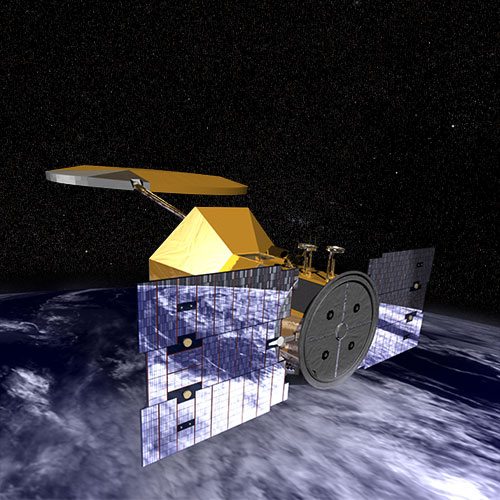
The Aquarius/Satélite de Aplicaciones Científicas (SAC)-D satellite observatory, was an international collaboration between NASA and Argentina’s space agency, Comisión Nacional de Actividades Espaciales (CONAE), with participation from Brazil, Canada, France and Italy.
The mission ended June 8 when an essential part of the power and attitude control system for the SAC-D spacecraft, which carries NASA's Aquarius instrument, stopped operating. The Aquarius instrument successfully achieved its science objectives and completed its primary three-year mission in November 2014.
Aquarius was a pathfinder mission to demonstrate that accurate, scientifically-significant measurements of salinity could be made from space. It was also the first mission to combine use of passive (radiometer) and active (radar) measurements at L-band.
The instrument’s surface salinity measurements are contributing to a better understanding of ocean dynamics and advancing climate and ocean models, both from season to season and year to year. These models still are improving El Niño prediction. Aquarius global salinity maps are revealing how freshwater plumes coming from the mouth of large rivers and the precipitation and evaporation over the oceans affect the salinity structure of the ocean.
Salinity information is critical to improving our understanding of two major components of Earth’s climate system: the water cycle and ocean circulation. By measuring ocean salinity from space, Aquarius provided new insights into the massive natural exchange of freshwater between the ocean, atmosphere and sea ice, which – in turn – influences ocean circulation, weather and climate.
Data from Aquarius revealed how extreme floods impact our seas and how low-salinity river plumes affect hurricane intensity. Aquarius data also were integral to the Salinity Processes in the Upper Ocean Regional Study (SPURS), a year-long international field study of the oceanographic processes that sustain the maximum surface salinities in the central subtropical North Atlantic, and influence global ocean circulation.
Key Aquarius Facts
| Mission/Portal Page: | http://science.nasa.gov/missions/aquarius/ |
|---|---|
| Altitude:Distance from sea level. | 657km |
| Inclination: | 98° |
| Local Node:Approximate time, at the equator when vehicle is directly overhead. | 6:00 a.m. |
| Origination: | NASA/Argentina |
| Instruments: |
L-band radiometer L-band scatterometer |
| Principal Investigator(s): |
Gary Lagerloef David Le Vine |
Related Publications:
- Aquarius/SAC-D (iBooks - 4.59 MB)
- Aquarius/SAC-D (Science Writers' Guide - 1.76 MB)
- Aquarius SAC-D (Lithographs - 623.67 KB)
- Understanding Earth: Our Ocean (Booklets - 10.39 MB)
Relevant Science Focus Areas:
- Climate Variability and Change
- Water and Energy Cycles
Relevant Science Questions:
- How does the Earth system respond to natural and human-induced changes?
- How is the global Earth system changing?
- How will the Earth system change in the future?
Science Goals:
- Observe and model the processes that relate salinity variations to climatic changes in the global cycling of water.
- Understand how these salinity variations influence the general ocean circulation.
Related Applications:
- Agricultural Efficiency
- Water Management