
You are here
Geostationary Operational Environmental Satellite D-H (GOES D-H)
Status:
Completed
Mission Category:
Inter-Agency Partnerships
Launch Date: September 9, 1980
Launch Location: Cape Canaveral, FL
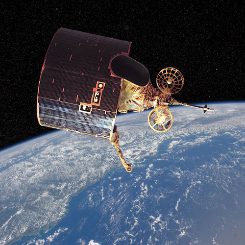
The Geostationary Operational Environmental Satellite-4 (GOES-4) advanced meteorologists’ capabilities by continuously profiling vertical temperature and water vapor. This major advancement permitted, for the first time, the monitoring of frame-to-frame movement of water vapor concentrations, a technique introduced by the European Meteosat-1 satellite. Meteosat-1 did not have profiling capability, but pioneered water vapor imaging in 1977. This new capability led to a greatly improved knowledge of global atmospheric circulation by revealing motions in clear areas where no visible clouds were present.
The GOES-4 and GOES-5, spacecraft developed by the Hughes Aircraft Corporation, were significantly different from the earlier Synchronous Meteorological Satellite (SMS)/GOES spacecraft. Onboard were a visible and infrared spin-scan radiometer (VISSR) atmospheric sounder (VAS). This instrument was a more sophisticated version of the VISSR onboard the earlier GOES spacecraft. The VAS had a new capability, atmospheric temperature sounding for gathering infrared (IR) radiation data which could be used, with known atmospheric properties, to calculate atmospheric temperature profiles over a selected geographic area. With the positioning of GOES-4 as the GOES-West satellite, and the positioning of GOES-5 as the GOES-East operational satellite, the users receiving the WEFAX broadcasts from either of these satellites were required to change the polarity of their antennas. While the S-band antennas on SMS/GOES spacecraft through GOES-3 had linear horizontal polarization (polarization parallel to the place of the equator), the GOES-4 and -5 spacecraft have parabolic antennas had linear vertical polarization (perpendicular to the plane of the equator). During the time of three simultaneous WEFAX transmissions, this difference required a user switching reception of broadcasts from either the GOES-East or -West to the GOES-Central, to change the polarity of the user’s antenna.
GOES-4 was placed in a geostationary orbit directly over the equator over the Pacific (135W). When the GOES-5 experienced a failure on July 30, 1984, GOES-4 was reactivated by the National Oceanographic and Atmospheric Administration (NOAA) to provide GOES-1 VISSR data relay services to western users.
Key Geostationary Operational Environmental Satellite D-H Facts
| Mission/Portal Page: | http://science.nasa.gov/missions/goes-l/ |
|---|---|
| Instruments: |
VISSR (Visible Infrared Spin-Scan Radiometer) VISSR Atmospheric Sounder |
| Program Scientist(s): |
Donald Fairfield Dennis F. Chesters William E. Shenk |
Relevant Science Focus Areas:
- Climate Variability and Change
- Weather
Relevant Science Questions:
- How is the global Earth system changing?
Related Applications:
- Weather Prediction