


Recent Imagery
You will be directed to the NASA Visible Earth webpage when you select Images by Mission below, or click on the images at right that are randomly generated to represent four out of all possible topics.

You are here
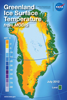
Greenland Ice Surface Temperature from MODIS
Thumbnail Image:
Description:
This lenticular card flips between monthly-average ice surface temperature (IST) of the Greenland ice sheet for July 2012 and July 2013, derived using data from NASA’s Moderate Resolution Imaging Spectroradiometer (MODIS) instruments onboard the Terra and Aqua satellites. In July 2012 approximately 99% of the top layer of the ice sheet melted for a short period of time—the greatest areal extent of surface melting in over 125 years.
Publication Type:
Year (YYYY):
2 015