- Home
- Missions
- Data
- Communications
- People
- The Earth Observer Newsletter


Recent Imagery
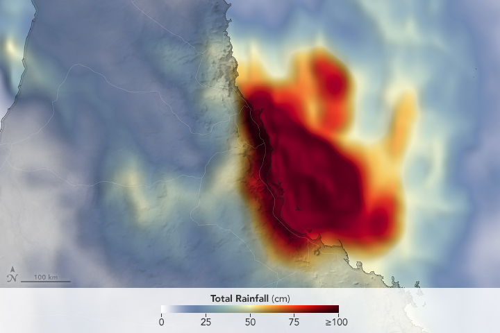
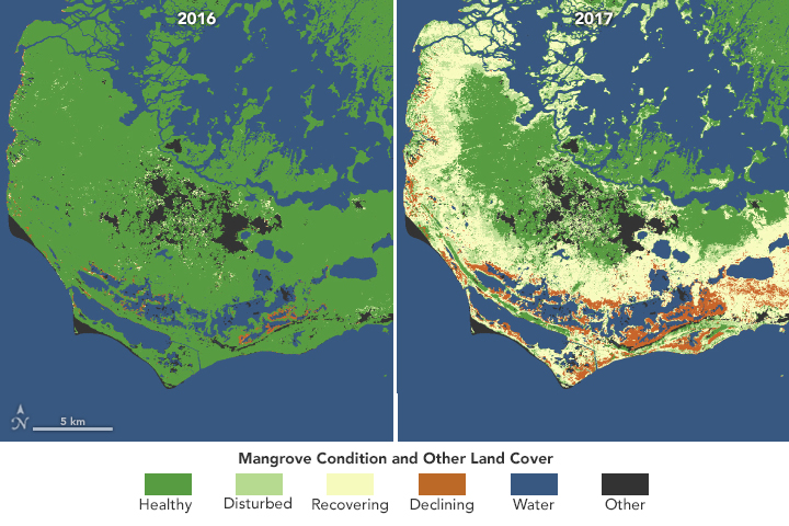
You will be directed to the NASA Visible Earth webpage when you select Images by Mission below, or click on the images at right that are randomly generated to represent four out of all possible topics.

Mission Category
|
Mission |
Mission Category | Status | |
|---|---|---|---|
 |
Sentinel-6B | Future | |
 |
Active Cavity Radiometer Irradiance Monitor Satellite (ACRIMSAT) | Completed | |
 |
Advanced Earth Observing Satellite (ADEOS) | Completed | |
 |
Applications Technology Satellite (ATS) | Completed | |
 |
Aqua | Current, Extended Mission | |
 |
Aquarius | Completed | |
 |
Atmospheric Laboratory of Applications and Science (ATLAS-1) | Completed | |
 |
Aura | Current, Extended Mission | |
 |
Challenging Mini-satellite Payload (CHAMP) | Completed | |
 |
Climate Absolute Radiance and Refractivity Observatory Pathfinder (CLARREO Path.) | Future, Implementation |