


Recent Imagery
You will be directed to the NASA Visible Earth webpage when you select Images by Mission below, or click on the images at right that are randomly generated to represent four out of all possible topics.

You are here
GRACE
Thumbnail Image:
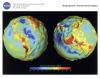
Description:
This lithograph displays the most accurate map to date of Earth’s long wavelength gravity field and is the first version to be released by NASA’s Gravity Recovery and Climate Experiment (GRACE) mission. We call these maps gravity anomaly maps because they show us how much Earth’s actual gravity field departs from "normal," as defined by a simplified mathematical gravity model that assumes the Earth is perfectly smooth and featureless. The maps reveal that the Earth is a restless, dynamic planet, both at its surface and deep within its interior.
Publication Type:
Year (YYYY):
2 001