


Recent Imagery
You will be directed to the NASA Visible Earth webpage when you select Images by Mission below, or click on the images at right that are randomly generated to represent four out of all possible topics.

You are here
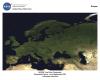
MODIS-Europe (2003)
Thumbnail Image:
File:
Description:
This spectacular Moderate Resolution Imaging Spectroradiometer (MODIS) image of Europe is based on the most detailed truecolor image of the entire Earth to date. Using a collection of satellite-based observations, scientists and visualizers stitched together months of observations of the land surface, oceans, sea ice, and clouds into a seamless, true-color mosaic of every square kilometer of our planet.
Publication Type: