


Recent Imagery
You will be directed to the NASA Visible Earth webpage when you select Images by Mission below, or click on the images at right that are randomly generated to represent four out of all possible topics.

You are here
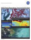
NASA Earth Observations Track the Gulf Oil Spill
Thumbnail Image:
File:
Description:
This lithograph discusses how current research projects are making use of NASA’s active and passive remote sensing capabilities to monitor oil spills. One such project is part of the NASA Gulf of Mexico Initiative, which began in response to the impact of Hurricanes Katrina, Dennis, Rita, and Wilma in 2005 and seeks to enhance the ecological and economic health of the Gulf.
Publication Type:
Year (YYYY):
2 010