


Recent Imagery
You will be directed to the NASA Visible Earth webpage when you select Images by Mission below, or click on the images at right that are randomly generated to represent four out of all possible topics.

You are here
Operation IceBridge (2010)
Thumbnail Image:
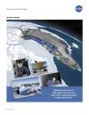
Description:
What’s Operation IceBridge all about? This one-pager sums it up, highlighting images and facts that characterize NASA’s six-year airborne mission to monitor Earth’s polar ice sheets, glaciers and sea ice. Display the front of the lithograph to showcase flight lines from the 2010 campaign over Arctic sea ice and Greenland’s land ice. Turn the lithograph over to read about the mission’s science goals, aircraft and instruments.
Publication Type: