


Recent Imagery
You will be directed to the NASA Visible Earth webpage when you select Images by Mission below, or click on the images at right that are randomly generated to represent four out of all possible topics.

You are here
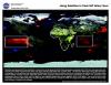
Using Satellites to Track Rift Valley Fever
Thumbnail Image:
File:
Description:
Rift Valley Fever (RVF), at least in the African country of Kenya, has been well known for over 60 years. As early as 1913, a disease fitting the description of RVF was blamed for the loss of sheep in the Rift Valley in kenya. However, it was not until scientists studied an outbreak of the disease in 1931 that a virus was isolated and shown to cause the disease. By using satellites to closely monitor the vegetation in the region affected by increased rainfall, scientists can identify likely habitats for the mosquitoes that carry the RVF virus, and provide advance warning of large-scale outbreaks of the disease.
Publication Type:
Year (YYYY):
2 000