

Recent Imagery
You will be directed to the NASA Visible Earth webpage when you select Images by Mission below, or click on the images at right that are randomly generated to represent four out of all possible topics.

Congratulations and Welcome Aboard!
Congratulations and Welcome Aboard!
Congratulations to the entire Landsat Data Continuity Mission (LDCM) team for a successful ascent and entry into the Morning Constellation, which now includes LDCM, Landsat 7, Earth Observing-1, Terra, and Argentina’s SAC-C spacecraft. The LDCM team completed the final orbit ascent maneuver on April 12, 2013 at 3:03 UTC. Post-maneuver orbit determination indicates that LDCM is sitting comfortably inside its +/-2 kilometer operational control box. The spacecraft continues to function nominally and science collection is providing the U.S. Geological Survey with hundreds of land scenes per day.
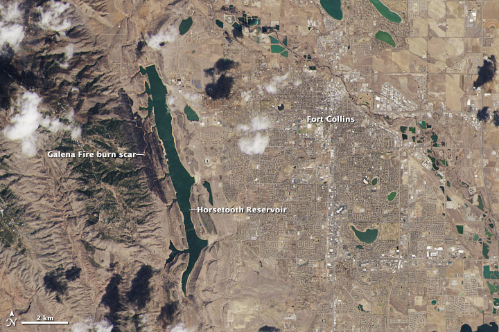
On March 18, 2013, LDCM began to send back images of Earth from both of its instruments. This view of Fort Collins, Colorado, is among the satellite’s first images. It is a close-up view from the Operational Land Imager (OLI) sensor at its maximum resolution of 15 meters per pixel. Made with reflected red, green, and blue light, the image shows the region as the human eye would see it. The city is a gray grid surrounded by curving roads and brown yards of residential neighborhoods. Bluish green bodies of water speckle the scene, while white clouds cast black shadows on the ground below. Image Credit: NASA's Earth Observatory