
Recent Imagery
You will be directed to the NASA Visible Earth webpage when you select Images by Mission below, or click on the images at right that are randomly generated to represent four out of all possible topics.
You are here
Brochures
NASA's Earth Observing System provides a variety of materials available for download. Feel free to choose a category below:
- Brochures
- Postcards
- Posters
- Science Writers’ Guide
- Mission Brochures
- Fact Sheets
- Calendars
- Booklets
- Lithographs
- Reference and Data Products Handbooks
- iBooks
- Activities
 |
Understanding Earth: What's Up with Precipitation? Precipitation is any product of the condensation of atmospheric water vapor that falls quickly from a cloud. The main forms of precipitation include drizzle, rain, sleet, snow, grapple (soft hail or snow pellets), and hail. Today, scientists can measure precipitation directly—using ground-based instruments such as rain gauges—or indirectly—using remote sensing techniques (e.g., from radar systems, aircraft, and Earth-observing satellites). This brochure describes how satellite observations—often combined with other measurements taken on the ground or from aircraft—provide frequent estimates of precipitation at a global scale. Among other uses, precipitation datasets from NASA are used for forecasting tropical cyclones; monitoring soil moisture conditions and freshwater availability; and predicting flood and drought conditions, landslides, crop yields, and water-related illnesses. This is related to the following mission(s): This publication appears in: |
 |
2015 Schedule of Events at the AGU NASA Booth |
 |
COP-21 Hyperwall Science Stories The twenty-first Conference of Parties (COP-21) to the United Nations Framework Convention on Climate Change will take place in Paris, France, November 30 to December 11, 2016. This brochure contains most of the science stories that will be shown on the Hyperwall at COP-21 grouped by theme. This publication appears in: |
 |
NASA Science Program Support Office Annual Report 2015 During FY2015, the Science Program Support Office (SPSO) supported 24 domestic and international science conferences and public events. Each year the SPSO strives to provide an inspiring and interactive venue, using a unique storytelling approach, that allows a variety of audiences worldwide to connect with NASA Science. The 2015 Annual Report provides a broad overview of these activities, along with details about new Hyperwall stories, publications, social media, key partnerships, and more! This publication appears in: |
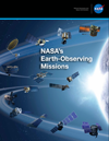 |
NASA's Earth-Observing Missions To study the Earth as a whole system and understand how it is changing, NASA develops and supports a large number of Earth-observing missions. This brochure provides an overview of NASA’s operating and future missions as of October 2015. This publication appears in: |
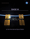 |
SAGE III on the International Space Station NASA’s Stratospheric Aerosol and Gas Experiment (SAGE) family of remote-sensing-satellite instruments has long measured ozone (O3) concentrations, stratospheric aerosols, water vapor, and other trace gases that influence Earth’s atmosphere. Planned for launch in 2016, SAGE III on the International Space Station will continue the legacy of accurate SAGE measurements. This brochure provides details about the instrument, launch and installation, ground system and data, and more! This publication appears in: |
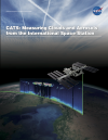 |
CATS: Measuring Clouds and Aerosols from the ISS In 2011 the International Space Station (ISS) NASA Research Office offered scientists at NASA’s Goddard Space Flight Center a mounting location onboard the space station for a new lidar instrument called the Clouds and Aerosol Transport System (CATS). Described in this brochure, CATS provides vertical profiles of cloud and aerosol properties at three wavelengths (1064, 532, and 355 nanometers). The CATS mission seeks to build on the CALIPSO data record, provide observational lidar data to improve research and operational modeling programs, and demonstrate new lidar retrievals of clouds and aerosols from space. These technologies and the science gained from the CATS mission will be used to design future missions that will study clouds and aerosols and their affects on Earth’s climate and air quality for years to come. This is related to the following mission(s): This publication appears in: |
 |
COP-20 Hyperwall Content This brochure provides information about the content displayed on NASA's Hyperwall in the U.S. Center at the twentieth session of the Conference of the Parties (COP-20) held December 1-12, 2014, in Lima, Peru. This publication appears in: |
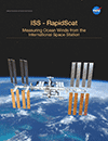 |
ISS-Rapid Scatterometer (2014) Described in this brochure, NASA’s International Space Station Rapid Scatterometer, or ISS-RapidScat, is the first scientific instrument specifically created to observe Earth winds from the space station. Scheduled for launch in late 2014, the experimental mission will measure ocean-surface wind speeds and directions, providing data that are needed to support weather and marine forecasting—including tracking storms and hurricanes—and climate research. The space station’s unique orbit will allow ISS-RapidScat to make the first direct observations of how ocean winds vary over the course of the day. This is related to the following mission(s): This publication appears in: |
 |
NASA Science Gallery The NASA Science Gallery reveals the “big picture” to help tell twelve fascinating stories about our changing planet. This publication appears in: |
