
You are here
Science Communication Material
NASA's Earth Observing System provides a variety of materials available for download. Feel free to choose a category below:
- Brochures
- Postcards
- Posters
- Science Writers’ Guide
- Mission Brochures
- Fact Sheets
- Calendars
- Booklets
- Lithographs
- Reference and Data Products Handbooks
- iBooks
- Activities
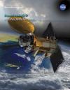 |
Aquarius/SAC-D Changes in sea surface salinity have large-scale effects on Earth’s water cycle and ocean circulation. Before now, scientists had studied these changes using measurements collected by ships and buoys out at sea. Fortunately, for the first time ever, NASA’s Aquarius/SAC-D satellite will provide space-based, global sea surface salinity measurements. Surface salinity data from Aquarius/SAC-D will give scientist a key to better understanding how ocean circulation is tied to global climate. This is related to the following mission(s): This publication appears in: |
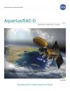 |
Aquarius/SAC-D The international Aquarius/Satélite de Aplicaciones Científicas (SAC)-D mission will provide, for the first time ever, NASA’s space-based measurements of global sea surface salinity. Scientists will use Aquarius/SAC-D data to develop a better understanding of our Earth’s water cycle and ocean’s circulation patterns. Aquarius observations will also contribute significantly to improving computer models used to forecast future climate conditions. This is related to the following mission(s): This publication appears in: |
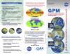 |
Global Precipitation Mission (GPM) Knowing when, where, and how much it rains or snow is vital to understanding how the Earth system functions. This brochure explains how GPM - an international satellite mission - will benefit all nations by unifying and advancing precipitation measurements from space for scientific research and societal applications. This is related to the following mission(s): This publication appears in: |
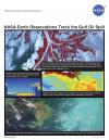 |
NASA Earth Observations Track the Gulf Oil Spill This lithograph discusses how current research projects are making use of NASA’s active and passive remote sensing capabilities to monitor oil spills. One such project is part of the NASA Gulf of Mexico Initiative, which began in response to the impact of Hurricanes Katrina, Dennis, Rita, and Wilma in 2005 and seeks to enhance the ecological and economic health of the Gulf. This publication appears in: |
 |
Our Changing Atmosphere: Discoveries from EOS Aura Aura is NASA’s third large Earth Observing System mission and is dedicated to understanding the changing chemistry of our atmosphere. View the latest brochure highlighting some of the discoveries from the Aura Mission. This is related to the following mission(s): This publication appears in: |
 |
SMAP An overview of the Soil Moisture Active Passive (SMAP) satellite mission in poster format. This is related to the following mission(s): This publication appears in: |
 |
SMAP Applied Science A complete description of the Soil Moisture Active Passive mission; the mission overview at-a-glance and the science driving the mission. This is related to the following mission(s): This publication appears in: |
 |
SMAP Products This poster shows sample products from the Soil Moisture Active Passive satellite mission. This is related to the following mission(s): This publication appears in: |
 |
Understanding Earth: The Journey of Dust In April 2001, the “Perfect Dust Storm” struck when wind whipped dust from deserts in Mongolia and China over Eastern Asia and the Pacific Ocean. Sensors aboard NASA Earth observing satellites tracked the movement and density of the aerosols as the cloud traveled eastward for more than two weeks. The booklet, “Understanding Earth: The Journey of Dust,” explains the causes of the 2001 storm, the effects of dust storms on society and climate, and possible ways to minimize their frequency. With satellite imagery, “The Journey of Dust” shows how NASA satellites provide a unique vantage point to observe and study these large-scale events. This publication appears in: |
 |
2009 NASA Science Mission Directorate |